
S. China Sea's Subsea Features Get New Chinese Names
On Tuesday, China released the results of a new geological survey of the South China Sea, and claims to have named nearly 400 subsurface features throughout the water body.
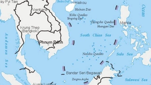
Beijing claims sovereignty over almost all of the South China Sea, including large swathes of its neighbors' exclusive economic zones. Its sweeping maritime claims were invalidated by the Permanent Court of Arbitration in the Hague in 2016, but China has ignored the ruling.
Yang Chupeng, an official with the Guangzhou branch of the China Geological Survey, told state media that the new survey results will "provide good services for our country's marine engineering construction." The survey data will facilitate the "development and protection" of "China's blue land," the agency said.
The survey process found 36 new seabed features that were previously unmapped, according to state media. The study also gave state officials the opportunity to give new names to 384 seabed landforms around the South China Sea.
The right to name seabed features is consistent with China's position on the South China Sea's ownership. Beijing has long claimed that it has “indisputable sovereignty over the islands in the South China Sea and the adjacent waters," including legal jurisdiction over the surface, seabed and subsurface mineral rights.
The data also has military applications. Fine-scale subsea mapping is useful for submarine warfare, as seabed features must be carefully mapped to safely navigate a sub near the bottom. (Subs can and do collide with unmapped promontories.) Seabed features can also be used to conceal a sub from detection.

that matters most
Get the latest maritime news delivered to your inbox daily.
The Washington-based Center for Strategic and International Studies recently published a summary of evidence that China's research vessels serve military purposes, like the research vessels of other naval powers. CSIS asserts that of the 64 active Chinese research vessels, over 80 percent demonstrate suspect behavior or possess links suggesting involvement in Beijing’s geopolitical agenda.
The Ministry of Natural Resources and Chinese Academy of Sciences both operate research vessels and have signed cooperation agreements with China's military. The China Geological Survey, which sponsored the large-scale mapping effort, is a division of the Ministry of Natural Resources.
