
S-100 Requires Real-Time Underwater Perception Where Data is Lacking
By Matthew Zimmerman, CEO FarSounder
The widespread deployment of S-100 based products is on the near-term horizon. With these products, the maritime world is on the cusp of a navigation transformation as impactful as the original transition from paper charts to ECDIS. However, missing from most of the discussion is the fact that the value of these new capabilities is dramatically limited when the underlying data sets are lacking. Only about 50% of coastal waters have been surveyed at modern standards and most of this coverage is limited to the main shipping channels and routes. For any vessel operating outside of these main routes, charted bathymetry cannot be relied upon. It is in these locations that real-time, underwater perception is required to ensure safe navigation.
Above-water perception systems such as radars and cameras are tools familiar to mariners on all types of vessels, and the fusion of radar data (along with AIS and targets detected from optical sensors) on top of the ECDIS is a standard feature on most integrated solutions. These above-water perception systems are very effective for supporting COLREG navigation, avoiding collisions with other vessels, bridges, and other marked structures. However, relying only on above-water perception systems revolves around the assumption that the charted bathymetry is an accurate representation of the sea floor; in many cases, this is dangerously incorrect.
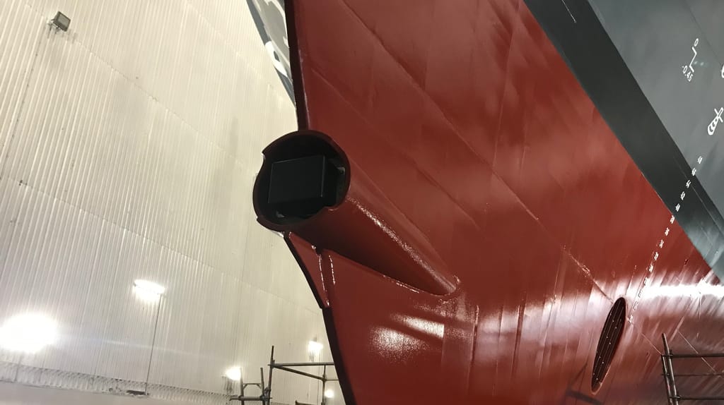
For 25 years, FarSounder has been developing and delivering underwater perception capabilities with its 3D Forward-Looking Sonar (3D FLS) technology. FarSounder’s Argos navigation systems produce a real time image of what is ahead of the vessel out to 1000 meters range (greater than ½ nautical mile). They also produce a bathymetric map of the sea floor everywhere the vessel goes, allowing the bridge crew to see what was present the last time the vessel visited the area. Additionally, should the user choose, their map can be shared anonymously across the FarSounder fleet and with Seabed 2030 via the IHO’s crowdsourced bathymetry initiative at the Data Center for Digital Bathymetry (DCDB). In return, they receive the aggregate map produced from everyone’s contributions.
FarSounder’s original motivation in developing its technology stemmed from an environmental perspective. Specifically, the team was motivated by finding a way to help ships avoid hitting whales, causing whale ship-strike deaths, and avoid hitting rocks, causing oil spills. In its inception, FarSounder’s products were designed as a stand-alone sensor. In the more than two decades since shipping its first products, the FarSounder team has continued its commitment to its original environmental motivations. All FarSounder sonars are designed specifically to be safe for whales and safe for the marine environment. The acoustic designs of all of FarSounder’s products have been developed with respect to NOAA’s acoustic harassment guidelines, with operating frequencies, duty cycles, and source levels chosen specifically to ensure that the sonars’ operation will not constitute acoustic harassment.
Now in its maturity, the team focuses on continuing innovations that improve overall vessel navigation safety and sees above-water sensors as a clear complement to its below-water sonars. FarSounder’s software is designed to provide an easy-to-use and quick-to-comprehend picture of the vessel’s overall real time navigation situation. The user interface fuses multi-domain maritime perception systems, consolidating targets and video from SEA.ai camera systems, AIS/ARPA targets and tracks, and AI-processed radar targets from Tocaro Blue along with its 3D sonar data, all overlaid on top of standard nautical charts and aerial imagery. In this manner, users can intuitively understand the current hazards (or lack thereof) around the vessel.
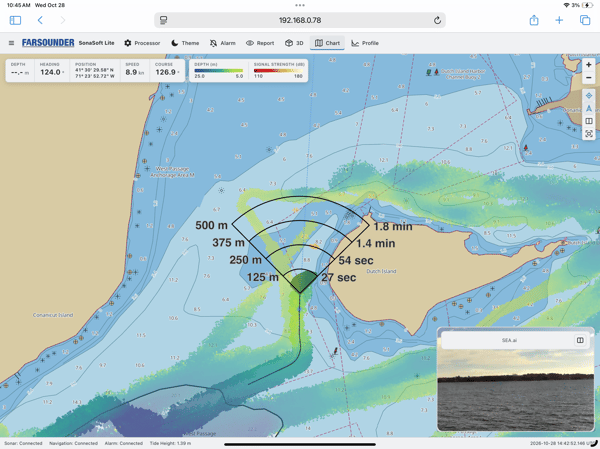
Because of FarSounder’s unique technology, the company’s strategy has always been to address unserviced industry needs rather than reinventing the wheel. In this respect, FarSounder’s software is explicitly not an ECDIS. It fulfills a different need of operator situational awareness. Argos sonars do, however, have direct integrations with a variety of 3rd party systems including the Anschütz SYNAPSIS NX and NACOS Marine ECDIS systems. Similarly, the systems include a machine interface which allows integration into 3rd party autonomy stacks including MarineAI and RoboSys.
The most basic piece of navigation information for a ship or boat is knowing what is ahead underwater. Understanding where the water depth is safe or dangerous and detecting in-water navigation obstacles is a common need for many types of vessels and maritime operations. FarSounder has been shipping COTS products globally since 2005, with a customer portfolio including cruise ships, patrol craft, superyachts, USVs from 6m to 60m in length, icebreakers, landing craft, research vessels, hydrographic survey vessels, and more. However, the company and its products are still relatively unknown.
It is clear that for any vessel operating in coastal areas outside of the main shipping channel (these are the areas that are mostly uncharted), the threat of underwater navigation hazards is greatly underestimated. However, threats of unknown obstacles are present even in locations often considered to be well surveyed and charted (such as the east coast of the United States). Recent work by Anthony Klemm, a Physical Scientist at NOAA’s Coast Survey Development Lab, comparing crowdsourced bathymetry (CSB) and satellite-derived bathymetry (SDB) with NOAA’s BlueTopo database and official nautical charts, shows numerous locations where charted data is dramatically wrong.
For example, a FarSounder customer transiting off the coast of Massachusetts near Nantucket passed over a shoal charted to be about 10-12 meters deep but measured with their sonar to be about 5 meters deep. Anthony analyzed this measured data, which was shared as CSB with the DCDB, and found that the shoal detected in the CSB data correlated with the seafloor trend he found in SDB data for the same location. Fortunately, the transiting vessel was a relatively shallow-draft pleasure craft. However, had it been a larger commercial vessel transiting at low tide, then a grounding could have resulted.
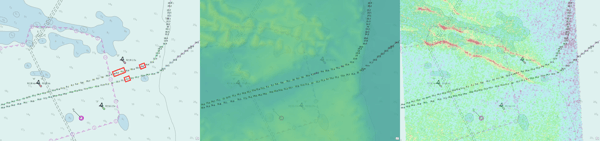
Anthony Klemm, NOAA Office of Coast Survey
Furthermore, this example is not a unique instance. Using CSB data, Anthony has been developing automated tools to find more and more of these locations in waters that are generally considered to be some of the best charted areas in the world. These results highlight the need for real time underwater perception capabilities across a wide range of vessel types.
FarSounder’s extensive, global dealer network can facilitate new-build and refit installations around the world with their in-house FarSounder-trained and certified technicians supported by FarSounder engineers. Learn more at FarSounder.com
The opinions expressed herein are the author's and not necessarily those of The Maritime Executive.