
Whale Protection Areas and Their Implementation in Future ECDIS

By Jens Schröder-Fürstenberg
Ships navigating at high speed are still a big danger for the animals in areas where whales are present. Speeds of more than 20 knots are not rare and whales have no chance to avoid “collisions” by themselves.
Several measures have been implemented to protect the whales. Recently, USCG has proposed new routes off California separating ships and whales from each other. The U.S. NOAA has jointly established new PSSA off the US east coast and large parts of the Caribbean with France’s Protected Areas Agency.
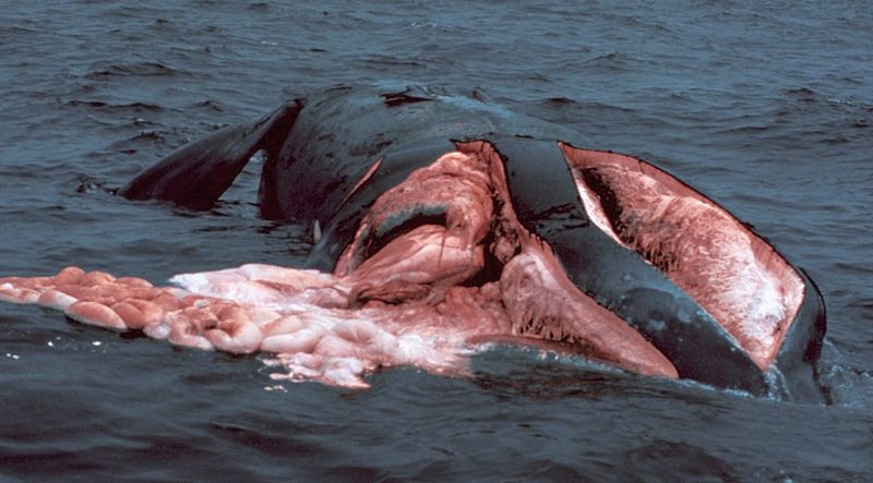
PHOTO: A dead North Atlantic Right Whale after being hit by a ship propeller.
Right Whales moving along the U.S. East coast and whale protection areas are established by the U.S. NOAA’s National Marine Fisheries Service (NMFS). Those areas, called “Seasonal Management Areas” (SMA) are seasonal. NMFS has also established “Dynamic Management Areas” (DMA) if whales are present outside the SMA. Those dynamic areas are being propagated in several ways. Mariners have to take care on that and have to navigate accordingly. Currently the mariner has to transfer the areas by hand onto the navigational, either paper or electronic. AIS can be used to display the spatial extent of both the seasonal and the dynamic areas on a navigational screen. The latter option depends very much on ship’s equipment.
Therefore it is very necessary to find a satisfactory way of presenting those areas and associated information for all vessels. ECDIS is flexible enough to merit consideration as a sufficient information provider. Actually the ECDISs use a data model called S-57 Standard. S-57 is frozen in many parts and the implementation of new information is difficult. The current ECDIS has limited updating frequency and provides mostly static information. That would make the proper presentation of those dynamic areas difficult if not to say impossible.
With the rollout of ECDIS carriage requirement as primary navigational tool for all SOLAS vessels starting 2012 both the administration and the mariner will have a new tool in hand to bring those areas to mariners’ attention and to have their spatial extent currently in force available on a chart (ECDIS screen) aboard. With better broadband and new techniques the updating of the information can be more frequent than today.
Since 2010 the International Hydrographic Organization (IHO) has established a new data framework called S-100 (http://www.iho.int/iho_pubs/standard/S-100/S-100_Info.htm). This framework, based on existing ISO 1900 series and extensions, can be used to develop ENC related products required by interested communities. One requirement is the implementation of nautical information in ECDIS systems. Taking this requirement into account is the main goal of the IHO’s Standardization of Nautical Publication Working Group (SNPWG). Besides the development and improvement of the data model to make nautical information compatible with ECDIS SNPWG is developing their first product specification. Also based on U.S. intervention SNPWG is developing a Product Specification for Marine Protected Areas (MPA).
This particular Product Specification can be used as a single product and as additional information to ENC. The MPAs are categorized using those categories provided by the International Union for Conservation of Nature and Natural Resources and those restrictions, e.g. Navigation Prohibited, already present in the current S-57 standard.
The presentation of the information to the mariner can be highly customized by referring to particular vessel’s characteristics. Additionally, the mariner can choose between different levels of information. The Annex provides examples of how the model can be applied to the Stellwagen Bank National Marine Sanctuary and to the Great South Channel Seasonal Management Area.
The product Specification is not complete yet. The SNPWG is making efforts to improve the Feature Dictionary and the Encoding Guide and liaise with other IHO working groups to find a portrayal solution which satisfactory.
About the author:

that matters most
Get the latest maritime news delivered to your inbox daily.
Jens Schröder-Fürstenberg works for the German Maritime and Hydrographic and Agency (BSH) as Head of the Nautical Publication and Nautical Archive branch. He is Vice-Chairman of the IHO Standardization of Nautical Publication Working Group. Since 2003 he has been working as ECDIS basics instructor at the Maritime Education and Training Centre Warnemünde of University of Applied Sciences Wismar.
His private homepage http://www.fuerstenberg-dhg.de provides one of the most comprehensive information sources on ECDIS Basics and ECDIS in Operation in German and English. The ECDIS part of his site received a Gold award from the Maritime Web Award for non-commercial sites.