
Kongsberg Discovery's Ocean Data Management with Blue Insight Geomatics
[By: Kongsberg Discovery]
Kongsberg Discovery, a global leader in underwater robotics and sensor technologies, has today unveiled Geomatics, a new digital product designed to transform how ocean data is captured, managed, and accessed.
Launched at Ocean Business 2025, the solution enables both traditional and uncrewed vessel operators to streamline data operations, unlock operational insights, and improve global collaboration between vessels and shore-based teams. Geomatics is the latest addition to Kongsberg Discovery’s Blue Insight ecosystem, delivering smarter data workflows and real-time visibility across diverse ocean sensor networks.
Welcoming the ‘data librarian’
As ocean activity accelerates and initiatives like the UN Decade of Ocean Science target efforts to map the seabed by 2030, the ability to manage vast volumes of complex data – across a myriad of sensors, formats and protocols - is more critical than ever.
Modern survey vessels, often operating as part of multi-platform fleets with AUVs and USVs, generate massive data streams from a wide range of environmental, meteorological and acoustic sensors.
“Survey teams are busy enough without wrestling with incompatible formats and fragmented systems,” comments Audun Berg, EVP of Kongsberg Discovery. “Geomatics takes the hassle out of data management, giving users a single, intuitive platform that lets them focus on the mission – simplifying complexity and optimising efficiency.
“Think of it as the perfect librarian for ocean data: one that makes sure all data is correctly filed, easy to find, and displayed clearly, for all relevant stakeholders. We see this as the revolution in data management operators need to meet increasingly ambitious surveying and research goals.”
Enabling smarter ocean operations
Geomatics operates as the first Blue Insight product, collecting a suite of software services on the platform to simplify ocean data management.
There are a compelling range of headline benefits. These include centralised data collection and logging from all onboard and remote sensors, automatic cataloguing and indexing to prepare data for exploration and analysis, and seamless data distribution to mirrored cloud environments or other data management systems.
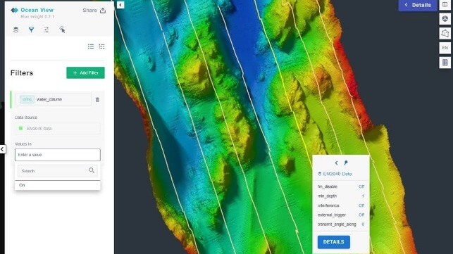
Visualisation of data is a key strength - empowering easier, quicker and more powerful insights – with both real-time and historical data georeferenced in dashboards, maps, and time series viewers, and a high degree of customisation available (allowing users to filter and tailor displays according to specific needs).
The Geomatics architecture is AI and machine learning ready, building a foundation for the integration of digital twin technology and further enhancing processing capabilities. A new Analytics product is also under development, allowing for automated processing and in-depth data analysis.
Seamless collaboration
“Geomatics has been built to enable excellence in the demanding domain of ocean research and surveying,” explains Berg. “It adds huge value by streamlining data collection, delivering real-time dashboard insights, and making data globally accessible, empowering better collaboration. From environmental monitoring to large-scale seabed mapping, Geomatics takes the pain out of juggling huge quantities of data, for faster, more efficient and accurate ocean discoveries.”
Early adopters have already been putting Geomatics through its paces ahead of today’s wider market launch, with the solution now being rolled out to several research vessels, including R/V Anna Weber-van Bosse, operated by NIOZ, the Royal Netherlands Institute for Sea Research, and Statsraad Lehmkuhl for the One Ocean Expedition (OOE).
Commenting on the latter, Geir Pedersen, Researcher and Member of OOE’s Scientific Committee, explains: “The One Ocean Expedition is once again setting sail and will be relying on Geomatics to catalogue the vast quantity of scientific data we collect with Statsraad Lehmkuhl. It’s vital to get a complete record of the data, while we keep control of data quality under the voyage. Researchers will benefit from seamless data access both onboard and onshore as they progress their vital work.”
The future is here
Geomatics is available from today. Survey and research teams can explore the platform by visiting this link and signing up for early access.
As part of the roll-out, Kongsberg’s existing Marine Data Management (MDM) product will be merged into Geomatics. Existing customers will be offered an attractive migration package to upgrade to Geomatics, or continue with technical support for a limited time.
Those who want to experience Geomatics ‘face to face’ and discuss the innovation with domain experts can visit Kongsberg Discovery’s stand at Ocean Business 2025, N1/P2. The show is taking place now, 8-10 April, at the National Oceanography Centre, Southampton, UK.
For further information please see https://www.kongsberg.com/
The products and services herein described in this press release are not endorsed by The Maritime Executive.