
ABPmer Makes Marine Vessel Traffic Dataset Available on AIS Portal
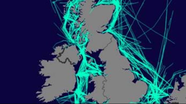
ABPmer’s GIS and Data Solutions team has today added the 2017 national dataset of marine vessel traffic for the UK to their online Maritime AIS data portal. This means users can now view and compare 2015, 2016 and 2017 vessel transits.
Vessel transits can be examined to identify traffic of a certain type, for example, traffic associated with a particular sector or type of activity. A further layer shows the average weekly density grid (heat map) for each year.
The data layers display AIS vessel transit lines from the Maritime and Coastguard Agency’s network of receivers, which ABPmer created on behalf of the Marine Management Organisation.
Raw AIS data, sampled from the first seven days of each month, has been processed to create the shipping density and route layers.
The data processing follows the UK Data Standard for AIS presentation established by ABPmer in ‘Mapping UK shipping density and routes from AIS (Project MMO 1066)’.
View 2017 AIS dataset at https://vision.abpmer.net/AIS/2017
The products and services herein described in this press release are not endorsed by The Maritime Executive.
