
NHC Hosts Hurricane Forecasting Webinars for Blue Water Mariners
The National Hurricane Center will be hosting their second annual live webinars on weather forecasting geared toward blue water mariners. These are available for up to 250 mariners with no cost to participants through GoToMeeting video conferencing. To sign up, register online at the links shown below.
“Hurricane Analysis and Prediction”
 Noon-1 PM EDT, Wednesday, August 4
Dr. Mike Brennan, Chief of the Hurricane Specialist Unit at the National Hurricane Center
Register at: https://attendee.gotowebinar.com/register/1007913929576201997
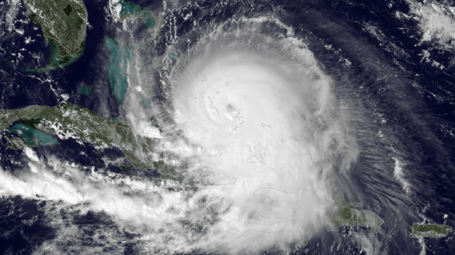
The Hurricane Specialist Unit (HSU) of the National Hurricane Center maintains a continuous watch on tropical cyclones and areas of disturbed weather within the North Atlantic and eastern North Pacific basins. The HSU prepares and issues analyses and forecasts in the form of text advisories and graphical products, issues coastal tropical cyclone watches and warnings for the United States and its Caribbean territories, and provides impact-based decision support services for federal, state, and local government partners.
HSU also coordinates with and provides watch and warning recommendations to other World Meteorological Organization (WMO) Region IV meteorological services. The HSU also conducts an extensive outreach and education program, training U.S. emergency managers, the media, and representatives from many other countries affected by tropical cyclones.
“Wind and Wave Prediction for the Blue Water Mariner”
 Noon-1 PM EST, Thursday, August 6th
Dr. Chris Landsea, Chief of the Tropical Analysis and Forecast Branch at the National Hurricane Center
Register at: https://attendee.gotowebinar.com/register/7528406009892549645

that matters most
Get the latest maritime news delivered to your inbox daily.
The Tropical Analysis and Forecast Branch (TAFB) within the National Hurricane Center makes forecasts of wind speeds/wave heights and issues wind Warnings year-round for 10,000,000 square nautical miles over the Atlantic Ocean north of the equator to 31°N and west of 35°W (including the Gulf of Mexico and Caribbean Sea) as well as the eastern North Pacific Ocean north of the equator to 30°N. These wind warnings include tropical storms and hurricanes as well as winter storms, tradewind gales, and severe gap-wind events (for example, the “Tehuantepecers” south of Mexico).
TAFB provides these forecasts under the auspices of both the U.S. National Weather Service and the International Maritime Organization. This presentation will review the analyses and forecast that are currently provided 365 days a year, 24 hours a day, as well as our impact-based decision support services for the U.S. Coast Guard, which relies upon the National Weather Service for weather forecasts and briefing support.
