
Low Water Conditions Continue to Worsen on the Lower Mississippi
Water levels on the Lower Mississippi have been low enough to cause serious difficulties for towboat navigation for weeks, and the situation has worsened enough that it is also impacting merchant shipping upriver of New Orleans.
Vessels transiting to Baton Rouge now must comply with a draft restriction of 41 feet due to low water, down from 45 feet. This measure covers a thirty-mile stretch between mile markers 168-203, limiting the draft for vessel access to areasd upriver of the affected section. This includes petchem terminals at Morrisonville, Plaquemine, and the massive Exxon Baton Rouge Refinery, a sprawling 540,000 bpd facility which ranks fifth in the nation for output.
Barge traffic interruptions appeared to worsen Saturday, according to Bloomberg. Despite recent attempts to refloat stranded tows and dredge out tough-to-navigate sections, the Lower Mississippi was closed to barge traffic in four places and 2,700 barges were backed up in queues, the Coast Guard said.
The ongoing drought in the Midwest has been under the radar, but the Mississippi River has dropped low enough in some places to temporarily block barge traffic. These @planet pics show a queue before & after dredging of the channel south of Memphis. https://t.co/ZGj49bFMVk pic.twitter.com/YHgvSjAw6x
— Rob Simmon (@rsimmon) October 22, 2022
The outlook for the coming months does not look favorable for barge operations, according to the National Oceanic and Atmospheric Administration Climate Prediction Center. The center's winter long-range forecast predicts continued drought conditions in the Mississippi's massive drainage area, which covers about 40 percent of the United States. A La Nina climate pattern is driving dry conditions throughout the western and central regions of the U.S., and relief may not come until the end of the winter.
Building a sill
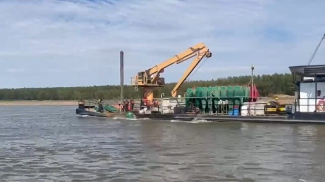
The Coast Guard is also implementing temporary measures for traffic at 64 miles above Head off Passes, where the U.S. Army Corps of Engineers is building an emergency saltwater barrier sill on the river bottom. With the river level and flow rate reduced, a wedge of heavier saltwater from the Gulf is penetrating upstream, threatening to contaminate drinking water supplies. The sill will prevent the further intrusion of saltwater above mile marker 64.

that matters most
Get the latest maritime news delivered to your inbox daily.
In the vicinity of the construction work, merchant ships are restricted to their slowest safe speed, and vessels may pass one way at a time only. Traffic must check in with the pilot aboard the dredging vessel before passing.
Aerial photos of the record low Mississippi River just south of Cairo, IL #ilwx #kywx #mowx #tnwx #arwx #mswx #lawx #mississippiriver #aerial #cairoil #sandbar #drought #barge #commerce pic.twitter.com/fvt9PiAro2
— Ohio Valley Aerial (@stmchsr01) October 15, 2022
