
New Ice Navigation System for North Pole Voyage
Germany’s only research icebreaker will embark on a voyage to drift, beset in ice, across the north pole in 2019. In attempting the epic journey, her crew will be using a newly-developed ice navigation system.
In the fall of 2019, the 118-meter (400-foot) icebreaker Polarstern will sail to 84 degrees N 120 degrees E, in the East Siberian Sea to be carried by the Transpolar Drift past the North Pole as part of a 1,500 mile, one-year research voyage.
The $70 million voyage is a joint effort by Russian, American, Chinese, British and German institutions and called the MOSAiC (Multidisciplinary drifting Observatory for the Study of Arctic Climate) mission. The research team's observations will help improve computer modeling of sea-ice environments, which will feed into larger-scale climate models developed by the World Weather Research Program and the World Climate Research Program.
Very few ships can break ice to access the ice-covered Arctic Ocean. And even those that can, including Polarstern, need a lot of information about sea ice state, wind and drift to navigate the ship through open leads, thin ice or to reach particular sites in due time.
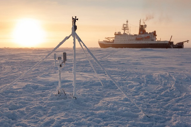 Credit: Alfred Wegener Institute / Mario Hoppmann
The Polarstern’s navigation system is a Marine Inertial Navigation System, but she will also have an additional system called IceGIS and developed by Alfred Wegener Institute sea ice physicists, other scientists and the ship’s crew.
Polarstern will drift with the ice, trying to hit sampling spots smaller than the size of a football field in depths of up to 3,000 meters (1.86 miles). IceGIS supports this challenge. It collects satellite data, weather forecasts and sea ice observations that are provided via internet link from different sources on land with shortest possible delay. They are then integrated into one information system producing maps. Then, additional forecasts of the vessel’s drift are generated on board. This combination of information is expected to substantially increased the vessel’s speed of operations in the ice.
The system was tested last year, and while the vessel sailed from the seamounts of Gakkel Ridge at 86°N and 60°E to Bremerhaven snow, fog and darkness reduced visibility to the point that on board helicopters could not be used for reconnaissance. Using satellite data for navigation, the microwave data showed a near complete ice coverage along the intended course, but the high-resolution radar images of European Space Agency's satellite Sentinel helped as did IceGIS, and the vessel was able to sail successfully at around four to five knots through the ice.
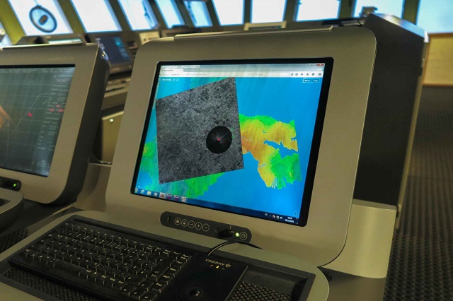 IceGIS on Polarstern’s bridge. The bridge radar is shown, projected on the latest satellite image of the sea cover and bathymetry in the background. (Credit: Alfred Wegener Institute / T. Krumpen)
Mosaic mission leader Professor Markus Rex of the Alfred Wegener Institute says the voyage will take place when the sea ice is thin. “We can make our way with our icebreaker Polarstern into the thin sea ice of the Siberian sector of the Arctic. Then we stop the engines and let the Polarstern drift.”
By November the vessel is expected to be enveloped in darkness and encased in solid sea ice, with temperatures will as low as -30oC. The scientists on board will set up an extensive network of research stations, in some cases travelling 50 kilometers (31 miles) from the vessel by helicopter.
They will release hundreds of helium balloons carrying sensors to take atmospheric measurements of super-cooled water in clouds. Water droplets can reach temperatures as low as -10oC without freezing, partly due to the pristine Arctic air, which is low in aerosols that would usually seed the formation of ice crystals in such temperatures. Increasing industrial activity in the Arctic could radically alter this process, Rex said.
As the polar winter turns to spring, the Polarstern will approach the Fram Strait between Greenland and Svalbard to exit into open water.
Polarstern is Germany’s biggest research vessel. The ship was commissioned in 1982 and is capable of breaking through 1.5-meter (five foot) thick ice with a speed of several knots; thicker ice can be overcome by ramming.
The vessel has a maximum draught of 11.2 meters (37 feet) and a maximum displacement of 17,277 tons. Her main engines are four KHD RBV 8M540 engines with 19,198 PS (14,116 KW), and they are run on diesel. She has a range of 19,000 nautical miles / 80 days. Polarstern’s ice reinforcement is to Germanischer Lloyd class 100 A 5 ARC 3 standard.
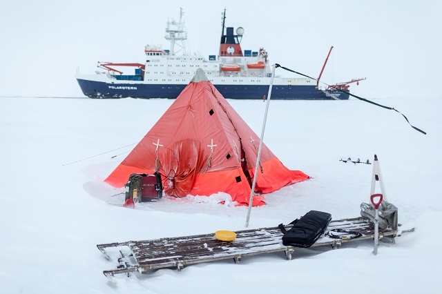 Credit: Alfred Wegener Institute / Mario Hoppmann
Throughout the voyage, Polarstern will be approached by other icebreakers for crew exchange and provisioning. The vessel has an Iridium-type Eurocom Marine satellite phone, especially for communication in high latitudes. The iridium system is integrated in the ship’s communication system, and it provides telephone and e-mail communication as well as (limited) internet access.
Emergency response plans are still being finalized, but the Polarstern has a hospital on board (including a telemedicine connection to a German hospital), a doctor and a nurse. There will be long range helicopters servicing the ship with supplies which could also provide emergency evacuation.
The expedition is not unprecedented. The route was first attempted by famed Norwegian explorer and Nobel laureate Fridtjof Nansen in 1893. Nansen locked his ship, the Fram, in the ice in the East Siberian Sea and drifted with the pack to 84 degrees N, then traveled by dogsled to 86 degrees 13 minutes N – a record at the time. His vessel emerged from the ice near Spitzbergen in the fall of 1896.
The 2019 MOSAiC mission using the Polarstern will be the first since then to traverse the polar ice cap by ship in this way.
The opinions expressed herein are the author's and not necessarily those of The Maritime Executive.
