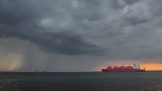
Location-Specific Weather Forecasts Boost Efficiency at LNG Terminals

Demand for liquid natural gas (LNG) will rise by 0.9 percent per annum by 2035. For many organizations around the world, this market growth creates new challenges for the safe transport of LNG.
Adverse weather conditions can dramatically impact safe and timely shipping operations. Whether located in the Gulf of Mexico or the Adriatic Sea, LNG ports and terminals must carefully monitor the weather to ensure that conditions do not exceed predetermined safety levels. To do so, they need access to reliable weather forecasts and guidance tailored to their precise location in order to support safety and operational decisions.
How weather conditions impact LNG port and terminal operations
The specific impact depends on whether terminals are onshore or offshore.
The main risks for offshore terminals are tropical storms and hurricanes. It’s essential to ensure they do not put lives at risk. Timing evacuations is a tough balance between safety and profitability. Evacuate too soon and it costs significant money; every hour a terminal isn’t operational, it loses thousands of dollars in revenue. Helicopters can provide swift transportation to and from offshore terminals, but planning safe and timely evacuations is critical. Leave too late and people could be injured or even killed.
Swells and high winds from tropical weather systems can affect onshore terminal operations. It’s challenging to maneuver LNG tankers in these conditions. Accidents caused by adverse weather can cause injuries and damage expensive assets, like loading docks.
Terminals located in channels connected to rivers can also be affected by significant rainfall, causing water levels to rise and currents to increase. Again, this scenario makes maneuvering and controlling the tankers difficult.
Location-specific forecasts matter for LNG ports and terminals
Around the world, LNG ports and terminals must contend with different weather challenges. For terminals in South America, specifically near Trinidad and Tobago, the islands can offer protection from wind and waves. However, wintertime weather systems can send large swells over one meter tall for 15 seconds or more in a southerly direction. These swells often force ships to temporarily leave the dock to avoid damage to loading docks, equipment, and the vessel itself. Accurate weather insights can ensure operations are scheduled to take advantage of optimal conditions and avoid unnecessary risks.
Operations at LNG terminals more inland, especially on the Gulf Coast, are primarily affected by winds, waves, and currents. These conditions make maneuvering vessels difficult, particularly near channel entrances. Heavy rainfall also creates challenging conditions for ships when docking and unloading. This rainfall causes rivers to swell, resulting in higher currents and tide differentials that create significant safety concerns.
But in the Adriatic Sea, it’s a different story. Strong Bora winds, with 40-50 knot gusts, can come from the mountains in Slovenia, making it impossible for ships to dock safely. Then, Sirocco winds can set up over the sea and bring swell surges from the southeast. The area also experiences severe thunderstorms in the summer that cause brief, but significant increases in winds and waves, as well as lightning, leading to substantial problems.
Off the Australian coast, there is a strong potential for severe thunderstorm squalls — sometimes, the surges are worse than the initial storm. While many predictive measures can help forecast when tropical cyclones will strike, having the longest possible lead time is critical — particularly for offshore LNG terminals that need to evacuate non-essential staff and equipment. At the same time, a long lead-time is vital for planning; every hour the terminal is shut down, the operating company takes a significant financial loss. Accurate weather forecasts allow terminal operators to make safety decisions that minimize downtime and financial losses.
Port and terminal operators use accurate weather forecasts to coordinate tanker arrivals during periods when the winds, swells, and currents are minimized, resulting in safer operations. Up-to-the-minute, localized forecasts accurately predict winds, thunderstorm squalls, wave amplitude, and periods and surges that occur before and linger after the storm has passed. This allows ship crews to coordinate arrivals to avoid significant weather events, and enables safe, efficient LNG loading and offloading.
Learn how to manage weather impacts on LNG ports and terminals with localized forecasts in our white paper: Planning LNG Ports and Terminal Operations in Unique Weather Environments.
This article is sponsored by DTN.
The opinions expressed herein are the author's and not necessarily those of The Maritime Executive.

