
Whale Atlas: An Easy-to-Use Mapping Tool for Whale-Safer Global Navigation
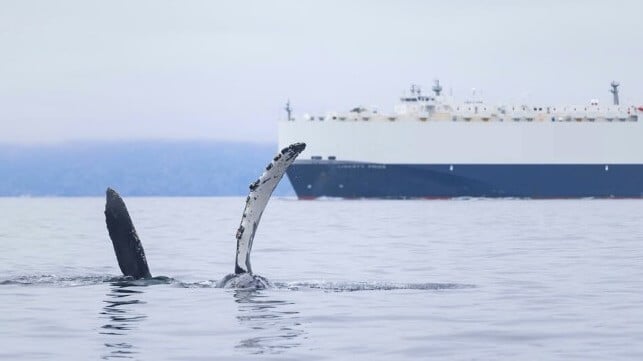
2025 has been a tumultuous year for large whales in California and beyond. At least eight gray whales have been killed by ship strikes just in the Bay Area. While the majority of ship strikes go unobserved and undetected, researchers estimate that 80 endangered whales are fatally struck each year off the West Coast of the U.S.
This reality was the impetus behind creating a new online portal which offers digitized details of whale conservation zones to make it easier for mariners planning multinational transits to understand and cooperate with whale-protection measures.
Background
In many places throughout the world, high-traffic shipping zones overlap with whale foraging areas and migration routes. Marine managers aim to reduce the risk of strikes by slowing ships down or asking them to avoid certain areas at certain times of the year. For the past ten years, Protecting Blue Whales and Blue Skies (BWBS) has engaged shipping companies, asking them to reduce their speeds voluntarily to a whale-safer level of 10 knots or less off the coast of California during peak whale migratory season. Programs like BWBS, which verifies cooperation with NOAA’s voluntary Vessel Speed Reduction (VSR) requests, work collaboratively with industry, and have been proven to be effective - reducing fatal strike risk by 50%. Where and when vessels reduce speeds is just as important as the slowing down itself. Resource managers use the best available science to determine the placement and timing of VSR zones.
Video credit: Katherine Brook; vessel and whale footage by Adam Ernster
Advancing global awareness and collaboration around whale protection measures
Whale conservation programs and protection measures centered on reducing shipping impacts on whales exist around the world, including in the Strait of Gibraltar; Hellenic Trench; Bering and Salish Seas; Costa Rica; Gulfs of Panama, Hauraki and Saint Lawrence; and the Canadian Arctic. In 2023 and 2024 the World Shipping Council released a first-of-its-kind Whale Chart Report that compiled and outlined whale protection measures across the globe in order to raise awareness to mariners of opportunities to reduce biodiversity impacts. This included VSR zones, Areas to be Avoided (ATBAs), and Traffic Separation Schemes (TSSs), all aimed at directing vessel traffic to either reduce speeds within or stay away from critical whale habitat areas.
Seeing an opportunity to make this valuable information more interactive and user-friendly, California Marine Sanctuary Foundation (CMSF) and the BWBS team developed an online platform to enhance how mariners access and engage with the information critical to understanding and cooperating with whale protection measures.
CMSF is proud to introduce “Whale Atlas: A Mariners Guide to Whale-Safer Shipping”
This new, online portal showcases digitized whale conservation zones and protection measures relevant to maritime shipping activities. It houses information on:
- Global VSR (Vessel Speed Reduction) zones, Areas to be Avoided (ATBAs) and Traffic Separation Schemes (TSSs)
- Zone designations and parameters, including which whale species it protects
- Seasonality of the whale protections
- Specifics of the measures (what speeds to slow to; ship class or size targeted)
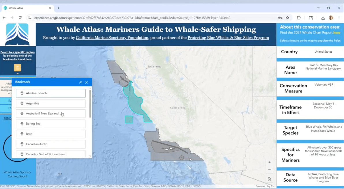 Whale Atlas with Monterey Bay National Marine Sanctuary selected, part of the NOAA voluntary VSR request, and Blue Whales Blue Skies program in California
Whale conservation zones represent areas where mariners are requested to either: reduce speeds or avoid important habitats for a few months or year-round. Whale Atlas provides this information, as well as the source/administering agency, so mariners can zoom in and out of relevant geographies, learn about opportunities to operate more sustainably, download layers in relevant formats, and incorporate measures into their transit plans.
CMSF and the BWBS team will regularly update the data to ensure that the conservation zones are current as guidance, data, and priority zones evolve. Maritime shipping is a global industry, and Whale Atlas brings us one step closer to ensuring that mariners consider whale-friendly shipping practices on the same global scale.
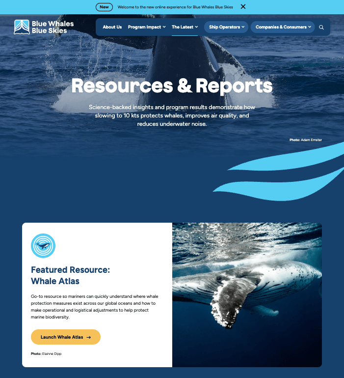
Whale Atlas is now live and can be found on the new Protecting Blue Whales and Blue Skies website at https://bluewhalesblueskies.org/resources/.
Danielle Alvarez is Marine Resource Protection Program Associate at the California Marine Sanctuary Foundation, which sponsored this message.
The opinions expressed herein are the author's and not necessarily those of The Maritime Executive.