
The IRGC's Positions on Larak Overlook the "Tehran Tollbooth" Route
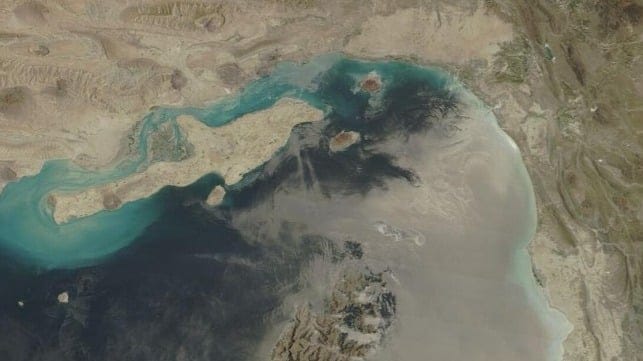
Larak Island, to the south of and covering the approaches to Iran’s largest port at Bandar Abbas, has achieved some notoriety in recent weeks as the island which Iran’s IRGC says merchant traffic must circumnavigate to transit the Strait of Hormuz on Iranian terms.
Larak is largely barren, a plug of sandstone 134 meters at its highest. The only settlement is the village of Larak on the northern side of the island, which is graced by the remains of a Portuguese castle. Locals get by with subsistence fishing, goat herding and smuggling, and hence the IRGC presence on the island is probably a substantial source of income. A feature of the landscape are recharge dams, designed to trap flood water and replenish local water supply when it rains occasionally.
There is little on the island by way of conventional military footprint, but IRGC facilities will merge with and be largely indistinguishable from the civilian infrastructure. The coast guard maintains a separate establishment to the IRGC Navy, but both communicate with passing sea traffic on the common Channel 16.
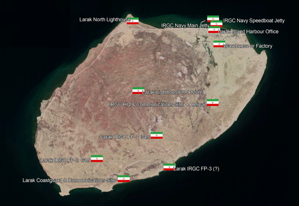
IRGC locations on the island of Larak (Google Earth/Copernicus/CJRC)
Lighthouses: Whether manned by coast guard or IRGC Navy staff, or both, Larak North Lighthouse and Larak Lighthouse on the high point of the island both provide visual observation of sea movements to north and south to fill out the maritime intelligence picture. Larak Lighthouse on the peak appears to have a coastal radar, two communications towers and in normal times flashes a white light every 12 seconds.
IRGC HQ & Communications Site: This is an active site, with until recently two tall communications towers, and a commercial ship’s radar on a 25-meter mast. The site has the only helipad identified on the island, suggestive of the headquarters function. The site also has garaging, which would be suitable for parking up anti-ship missiles and drones on mobile launchers.
Prepared Firing Points (FP1-3): Three prepared locations, each comprising three or more earthwork firing platforms, dominate the strait to the south. All three locations are connected to the island’s road network, so that mobile launchers can quickly reach these positions from hidden or protected storage locations elsewhere on the island. These storage locations cannot easily be identified, and may include caves and underground tunnels, but the IRGC also has protocols for keeping mobile drone and missile launchers in civilian buildings and warehouses. There is a substantial warehouse just south of the village of Larak, for which there is no obvious or declared purpose, which could be such a storage facility.
IRGC Navy Facilities: The IRGC Navy uses the only harbor on the island with a breakwater at Larak village. Before the current war, two 17-meter Peykaap II-class missile boats were frequently seen berthed on the main jetty in the harbor. The Peykaap II are each equipped with a pair of single Kowsar or Nasr anti-ship missile launchers, with the missiles using internal guidance and active terminal homing out to a range of 20 nm. At a second jetty close by, also seen on recent overhead visits, was an average of six fast speed boats, of the Taregh Class or smaller. These two jetties appear, from the low resolution imagery still available since February 28, to be the only two sites which may have been attacked.
Given the covert character of the IRGC presence on Larak Island, some capability is likely to have survived since February 28. Mobile drone and missile launchers can be hidden with relative ease, and replacements may have been brought onto the island during the ceasefire to replace any stock which has been destroyed, such that some offensive drone and missile capability may still be in place. In any case, the most important role for the island in the IRGC scheme of battle is to act as an observation post, from which to maintain surveillance of the Strait and from which to cue strike assets held elsewhere.

that matters most
Get the latest maritime news delivered to your inbox daily.

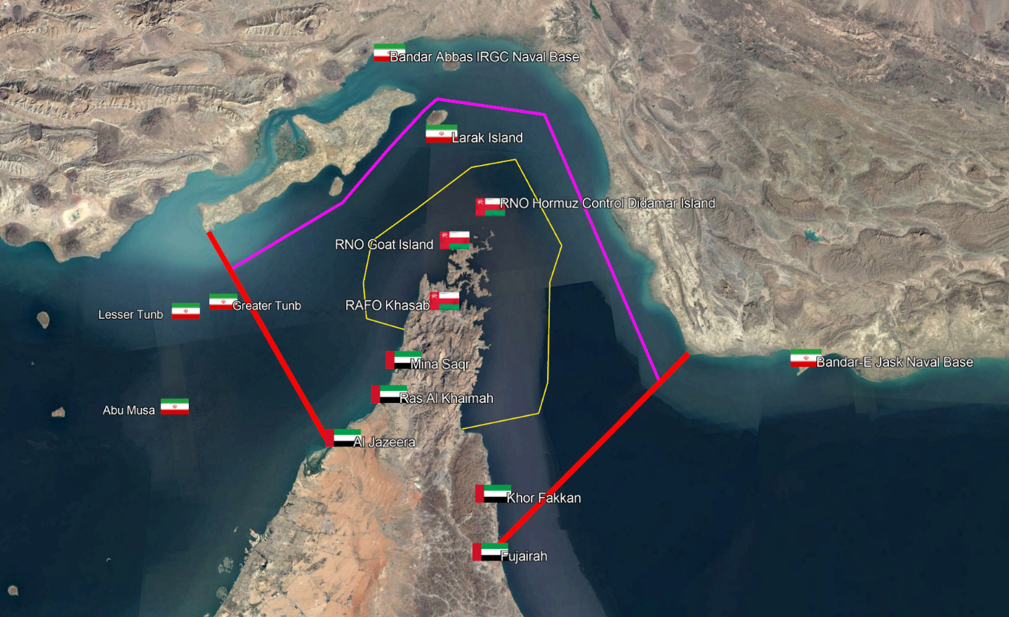
Larak Island sits at the northern tip of the IRGC’s recently-declared prohibition zone. Red boundaries show the approximate border of the prohibition zone, and the Iranian shipping channel is show in purple. The border of Omani territorial waters is marked in yellow. The Disputed Islands in the western approaches to the Strait are occupied by Iran (Google Earth/Copernicus/CJRC)
