
MH370: A Rapid, Uncontrolled Descent Into the Sea
The Australian Transport Safety Bureau (ATSB) has released its latest update report on the search for Malaysia Airlines Flight MH370 indicating that the aircraft most likely made a rapid and uncontrolled descent into the Indian Ocean.
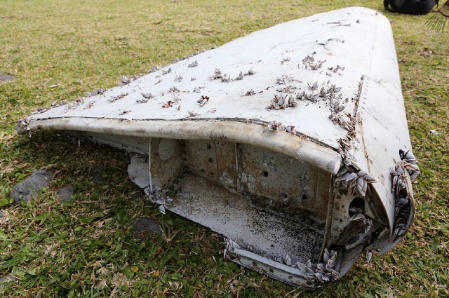
An analysis of two recovered wing flaps indicated that they were retracted and not in the landing position when the plane went down in the Indian Ocean. Satellite data also indicated a high and increasing rate of descent for the aircraft.
.jpg)
The Boeing 777 disappeared en route to Beijing from Kuala Lumpur with 239 people on board in March 2014. More than 110,000 square kilometers (42,000 square miles) of Indian Ocean seafloor have been searched so far but no trace of the plane’s fuselage has been found.
The report MH370 – Search and debris examination update provides an update of the MH370 search area definition which includes further analysis of satellite data, additional end of flight simulations, a summary of the analysis of the right outboard wing flap and preliminary results from the enhanced debris drift modelling.
In April 2016, the ATSB defined a range of scenarios for the aircraft manufacturer to simulate in its engineering simulator. Reasonable values were selected for the aircraft’s speed, fuel, electrical configuration and altitude, along with the turbulence level.
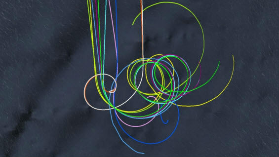
In some simulations, the aircraft remained airborne approximately 20 minutes after a second engine flameout. In a simulation where the loss of engine power from one engine resulted in the loss of autopilot, the aircraft descended in both clockwise and anti-clockwise directions. Simulations that exhibited less stable flight resulted in higher descent rates and impact with water closer to the engine flameout location.
The results of the scenarios indicate that the previously defined search area width of plus or minus 40 nautical miles is an appropriate width to encompass all uncontrolled descent scenarios from the simulations.
Currently, more than 20 items of debris have been brought to the attention of and are of interest to the investigation team. The items have been located along the east and south coast of Africa, the east coast of Madagascar and the Islands of Mauritius, Reunion and Rodrigues in the Indian Ocean.
Preliminary results of the CSIRO’s drift analysis indicated it was unlikely that debris originated from south of the current search area. The northernmost simulated regions were also found to be less likely. Drift analysis work is ongoing and is expected to refine these results.
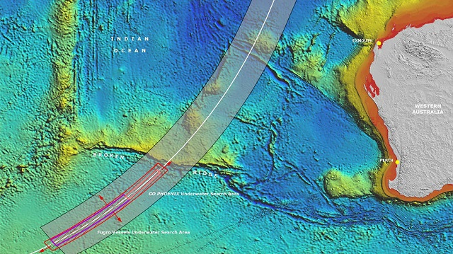
At a meeting of Ministers from Malaysia, Australia and the People’s Republic of China held in July 2016, it was agreed that should the aircraft not be located in the current search area, and in the absence of credible new evidence leading to the identification of a specific location of the aircraft, the search would be suspended upon completion of the 120,000 square kilometer (46,000 square mile) search area.

that matters most
Get the latest maritime news delivered to your inbox daily.
Due to poor weather conditions over the southern hemisphere winter, it is expected searching the entire 120,000 square kilometer search area will be completed by around January or February 2017.
The report is available here.