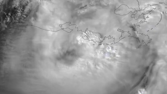
Hurricane Francine Makes Landfall in Louisiana

On Tuesday evening, Hurricane Francine made landfall in Terrebonne Parish, Louisiana, bringing Category 2 wind speeds and dangerous storm surge. High-elevation wind shear prevented the storm from further strengthening before landfall, limiting its power and potential for damage.
As the storm moved inland, it weakened, and wind speeds fell to Category 1 levels by 1900 hours. It remained a hurricane as it moved past Morgan City, Louisiana, weakening gradually into a tropical storm as it passed New Orleans.
In Terrebonne Parish, where the storm made landfall, county officials have announced a strict nighttime curfew. The local authorities are working to clear roads of debris and powerlines, but driving remains dangerous, according to the county sheriff.
Heavy rain from Francine's outer bands inundated New Orleans, flooding roads and low-lying areas. The hurricane caused damage to the power grid, taking some of New Orleans' drinking water pumping stations offline, and utility Entergy cautioned that it could take as long as 10 days to fully restore power to all affected areas.
The storm had an immediate effect on oil and gas production, both onshore and offshore. The port of Houma is closed, along with the Louisiana Offshore Oil Port (LOOP), America's only VLCC-capable loading termina. Shell has halted crude loadings at its Zydeco Houma terminal, and Chevron has temporarily suspended operations at its terminal in Empire, Louisiana.

that matters most
Get the latest maritime news delivered to your inbox daily.
Offshore, about 170 manned platforms have been shut down and evacuated, representing about half of all installations in the Gulf. Four DP drilling rigs moved off location in advance of the storm, and three non-DP rigs were evacuated as a precautionary measure. The Bureau of Safety and Environmental Enforcement estimates that about 39 percent of current oil production and 49 percent of current natural gas production in the Gulf of Mexico has been shut in due to the storm.
As Francine moves inland, it is expected to bring heavy rainfall and the risk of flash flooding across southeastern Louisiana, Mississippi, Alabama and the Florida Panhandle. It should weaken into a tropical depression by Thursday as it transits over Mississippi.
