
German NGO Comes Up With AI-Based Tool to Find Ghost Nets
A German NGO has come up with an AI-assisted tool for finding ghost nets - the drifting, abandoned fishing gear that hoovers up sea life indiscriminately.
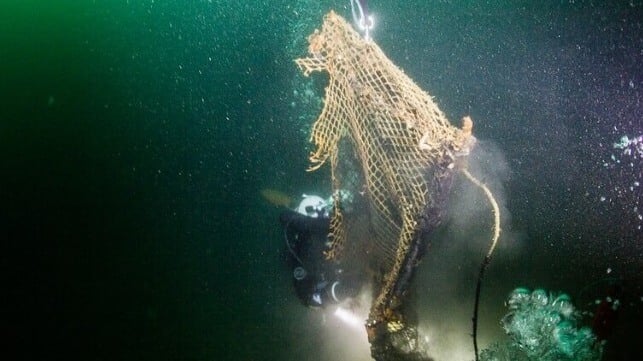
About 50,000 tonnes of fishing gear end up in the ocean every year, accounting for nearly a third of all ocean plastic waste. The gear gradually decomposes into microplastic, which enters the marine food chain with unknown consequences for the ecosystem (and for consumers of seafood).
But long before they break down, abandoned nets ensnare turtles, fish, sharks and other creatures, reducing the health of marine fisheries and taking a toll on threatened species. To fight this long-term threat, WWF Germany has worked with Accenture and Microsoft AI to put together an AI-driven ghost net identification platform.
The process starts with sonar data, obtained by organizations of all kinds (oceanographic research groups, offshore energy companies, and government sources) and donated to the projcet. When this data is uploaded into the cloud-based AI identification platform - GhostNetZero - the system automatically scans the sonar data for the telltale signs of drifting ghost nets. Previously, the only way to do this was to search the data manually - a time-consuming process, if proven to work. WWF Germany has used manual sonar searches for its cleanup work in the past, and has removed more than 20 tonnes of abandoned nets from the bottom of the Baltic.

that matters most
Get the latest maritime news delivered to your inbox daily.
But to maximize the platform's impact, WWF Germany says that it is looking for new participants from industry. Any group with high resolution sonar data to share can help out. In return, partners get the right to use the group's partnership logo.
"The combination of sonar search and AI-supported detection enables a quantum leap: the seabed is mapped all over the world and there is a huge amount of data. If we can specifically check existing image data from heavily fished marine zones, this is a real game-changer," WWF Germany project manager Gabriele Dederer told Oceanographic Magazine.